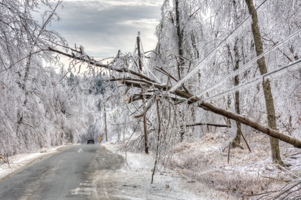
Two powerful winter storms are set to impact a large portion of the United States this week, bringing heavy snowfall, freezing rain, and the potential for flash flooding. Major cities, including Chicago and Washington, D.C., are expected to see some of their highest snow totals of the season.
The first storm will begin Tuesday morning, stretching from Colorado to Delaware, and will continue through Wednesday. The second storm will quickly follow, bringing additional snowfall to the Midwest before spreading across the East Coast.
Contents
First Storm: Heavy Snow and Rain Tuesday Into Wednesday

The first storm will cover a wide area, impacting states from the central U.S. to the East Coast. By early Tuesday morning, heavy rain will stretch from Dallas to Nashville, while snowfall will spread from Louisville, Kentucky, to Richmond, Virginia.
- Snow is expected to arrive in Washington, D.C., by noon on Tuesday and may continue for more than 12 hours.
- Some light snow may extend as far north as Philadelphia.
- The D.C. and Baltimore region could see between 4 to 6 inches of snow.
In the South, heavy rainfall will create a threat of flash flooding, particularly in areas already experiencing saturated ground conditions.
Second Storm: Midwest to the East Coast

As the first storm exits the East Coast, the second storm will be moving into the Midwest by early Wednesday. By 7 a.m. ET, widespread snowfall is expected across Colorado, Iowa, and Missouri, while heavy rain will develop from Houston to Louisiana.
Chicago will be one of the hardest-hit cities, with snow beginning around 9 a.m. Wednesday and lasting for more than 12 hours. The city could see between 5 to 9 inches of snowfall, making it one of the most significant snow events of the season.
By Wednesday evening, the second storm will spread toward the East Coast, bringing a mix of rain and freezing rain:
- Washington, D.C., and Philadelphia – Freezing rain and rain will begin after 5 p.m. Wednesday and continue overnight.
- New York City and Boston – Snow will begin Wednesday night before transitioning to rain overnight, creating hazardous road conditions.
Combined Impact of Both Storms

The back-to-back storms will lead to major travel disruptions across the Midwest, Mid-Atlantic, and Northeast. The combination of heavy snow, freezing rain, and strong winds will create hazardous conditions on roads and runways.
Meanwhile, the South will face the threat of flash flooding due to persistent heavy rainfall. With both storms combined, snow totals in the Midwest and Mid-Atlantic could be significant, while parts of the South could see widespread flooding concerns.
Preparing for Severe Weather
Residents in the affected areas should prepare for potential travel delays, power outages, and hazardous conditions. Those in regions expecting heavy snow should have emergency supplies ready, while those in flood-prone areas should stay alert for rising water levels.
With the storms set to hit back-to-back, staying informed and taking precautions will be key to staying safe as the severe winter weather unfolds.
For the latest updates and detailed coverage on this topic, go to our X page. Stay informed with real-time news and insights.


